Field Operations
Deliver smarter, faster, and more connected field service with Maptaskr Power Maps — built natively for Microsoft Dynamics 365 Field Service and the Power Platform.

Enhance Field Operations with Intelligent Geo-Productivity
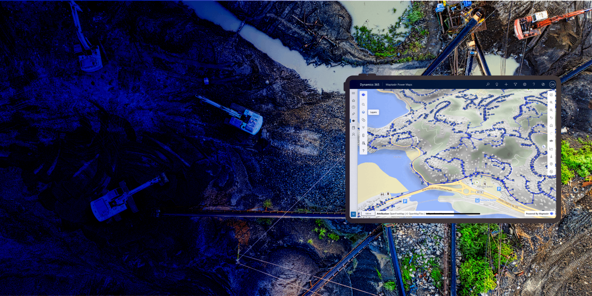
Maptaskr Power Maps enhances Microsoft Dynamics 365 Field Service with powerful, map-driven visibility of your operations. Field teams can instantly locate assets, job locations, and service issues with pinpoint accuracy — using aerial imagery, layers, and geospatial context to make better decisions faster.
Whether online or offline, Power Maps ensures technicians have the information they need on site to assess, plan, and complete work efficiently. The result: fewer delays, smarter routing, and consistently higher service performance.
Field service teams often struggle with fragmented location data, limited visibility, and disconnected systems that make it hard to plan efficiently or respond quickly. Maptaskr Power Maps solves this by embedding advanced mapping and geospatial intelligence directly inside Microsoft Dynamics 365 Field Service — giving schedulers, dispatchers, and technicians instant spatial context.
From locating assets and jobs to tracking crews in real time, Maptaskr provides a unified view of your operations. Built specifically for Field Service, it improves coordination, reduces travel time, and enhances decision-making — all within your existing Dynamics 365 environment.
Overview

Why Use Maptaskr for Field Operations?

Keep operational data safe within Microsoft’s trusted environment — protected by enterprise-grade security.

Improve precision and efficiency with location-aware work orders that sync job, asset, and spatial data in real time.
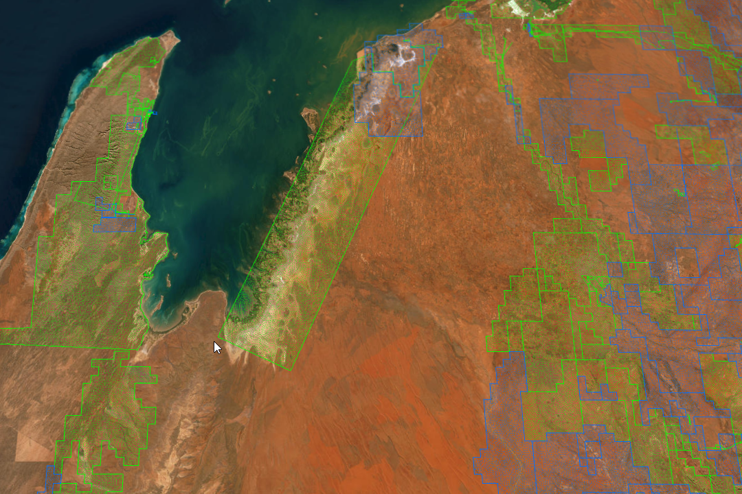
Connect to Esri ArcGIS and other GIS systems to deliver unified, enterprise-grade geospatial intelligence in Field Service.

Intuitive and reliable — mapping tools made for technicians and schedulers, not GIS specialists. Works online or offline.

Eliminate duplicate records and disconnected systems with a single, trusted geospatial view of your field operations.

Give dispatchers and technicians the clarity to visualize, analyze, and act on live data wherever they work.
Maptaskr Power Maps deploys instantly within your Microsoft environment — no external setup, tools, or integrations required. With a single click, the Field Operations solution is ready to go, featuring pre-configured maps, data layers, and forms built for Dynamics 365 Field Service.
For organizations integrating with enterprise GIS platforms such as Esri ArcGIS, Maptaskr Power Maps connects seamlessly, combining authoritative spatial data with field operations to deliver a single, trusted view of your world.
And for those who need more flexibility, Power Maps can be extended to include additional maps, layers, or custom configurations — giving you full control to tailor each experience to your organization’s unique needs.
How it Works
Real-World Applications
Assign and schedule work orders based on technician location and workload to reduce delays and improve response times.
Overlay assets and upcoming jobs on a single map to give schedulers and dispatchers complete operational visibility.
Detect recurring faults and plan proactive inspections before issues escalate or impact service delivery.
Monitor field staff and job progress in real time to enhance situational awareness and accountability.
Leverage aerial, terrain, and GIS data layers to plan and execute remote jobs confidently, even offline.
What Customers Say
“This functionality has been game-changing. It’s allowed us to complete maintenance works on the first try, saving hours of unnecessary searching and enabling us to resolve issues faster.”
– Patrich Ancheta, Asset Performance and Enhancement Manager
Melbourne Airport
