Enterprise GIS Integration
Connect, visualise, and act on spatial data from any source - without limitations
Maptaskr Power Maps enables organisations to integrate and work with geospatial data from a wide range of providers and formats - not just Esri ArcGIS. By supporting industry-standard layer types including ArcGIS Online and Enterprise, WMS, WFS, WMTS, MapLibre styles, and slippy image layers, Maptaskr provides a flexible foundation for building a truly connected mapping experience.
This allows businesses to bring together satellite imagery, drone feeds, enterprise GIS data, and web-based mapping services into a single, unified view. Users can visualise, interact with, and analyse this data directly within Dynamics 365, Power Apps, and Power Pages - without needing to switch systems or manage complex integrations.
By removing dependency on a single provider and supporting open standards, Maptaskr ensures organisations can leverage their existing investments while remaining adaptable to future data sources and technologies.
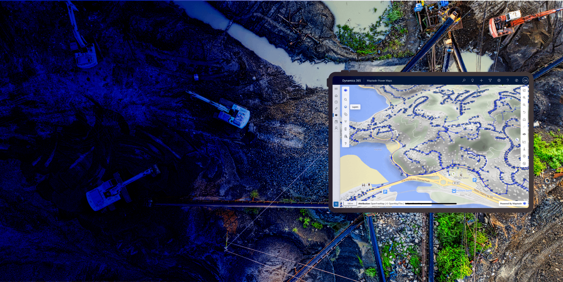
Connect to Any Geospatial Data Source
Maptaskr supports a wide range of industry-standard formats, including ArcGIS Online and Enterprise Feature and Map Layers, WMS, WFS, WMTS, MapLibre style specifications, and slippy (XYZ) image layers.
This flexibility allows organisations to integrate data from multiple providers - including satellite and drone imagery platforms - without being locked into a single ecosystem. The result is a more complete and adaptable view of your spatial data landscape.
Bring all Your Data into One View
Combine business data from Dataverse with external geospatial sources to create a single, unified map experience.
Users can toggle layers on and off, query datasets, search for features, and explore map data interactively.
This enables teams to see customers, assets, and operational data in the context of real-world geography - improving situational awareness and supporting more informed decision-making across the organisation.
Enable Location-Based Insights and Analysis
Combine business data from Dataverse with external geospatial sources to create a single, unified operational map.
Users can toggle layers, query datasets, search for features, and explore spatial data interactively - bringing customers, assets, and operations into real-world geographic context. This unified view improves situational awareness and supports faster, more informed decision-making across the organisation.
Leverage High-Resolution Imagery
Support for slippy (XYZ) image layers enables access to a wide range of satellite and drone imagery providers, including self-hosted and licensed sources.
This allows organisations to incorporate up-to-date visual context into workflows such as site inspections, asset monitoring, and environmental analysis - without being restricted to a single imagery provider.
Secure and Governed Integration
Maptaskr integrates securely with enterprise GIS platforms using established standards such as REST services and OAuth 2.0, enabling seamless access to authoritative geospatial data without compromising organisational security controls.
Rather than duplicating or extracting data into external systems, Maptaskr connects directly to GIS services such as ArcGIS Online, ArcGIS Enterprise, and OGC-compliant endpoints (WMS, WMTS, WFS), allowing users to work with live, authoritative data in place.
-
Break Free from Single-Provider Limitations
Work with data from multiple geospatial platforms and formats in one unified experience.
-
See the Full Picture
Combine satellite imagery, GIS layers, and business data to gain complete spatial context.
-
Turn Data into Actionable Insight
Interact with and analyse geospatial data directly within your existing business applications.

Want to bring all your geospatial data together to unlock deeper insight and drive more informed decisions across your organisation?