
Telecommunications
TelecommunICATION
How do you communicate with your customers?
Digital experiences drive new revenue and differentiation for the Telecommunications sector.
At Maptaskr, we know the importance of data. What if you could display your data on a map and have actionable insights wherever you are? Have your data or information in one place to inform the right decision and keep your field staff safe when they are visiting sites and assets. A Field Worker spends on average 37-40% of their working week on non-revenue generating or non-service-related tasks.
communICATION
Use the latest technology to help you service and increase productivity.
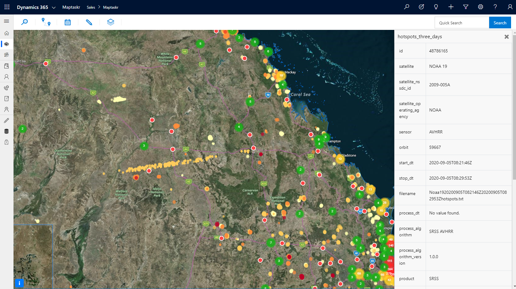
See weather forecasts, surroundings, and any potential hazards all on a map!
Maptaskr is a comprehensive field sales solution for sales professionals, sales managers and sales operation. Designed to enhance the sales organisation to improve sales performance, reduce operation costs and improve sales team retention. Used by thousands of sales professionals globally, Maptaskr brings focused visibility to their prospects and sales opportunities, while allowing them to plan better and reduce travel time so they can see more customers and close more sales.
Western Power is using Maptaskr to communicate with their 2.5 million customers. If there is a bushfire or storm, they can quickly communicate with their customers and inform the next course of action. Western Power now uses a matter of minutes to find the right customers to communicate to instead of hours or days!

Access your geospatial data
Communication with your customers, whether they are service announcements or planned outrages in specific areas, can be challenging. With Maptaskr, you can identify the area you would like to target, select the customers/contacts, and communicate easily.
Esri arcgis connect
Collaborate with colleagues and external customers by sharing maps; create Geofencing Areas, job site security, and employee clock-in/clock-out.

View assets
Create and trigger custom workflows to automate different business processes. Easily manage tasks, view customer records, book a meeting, route plan, and one-click “word order”.
asset information mapped
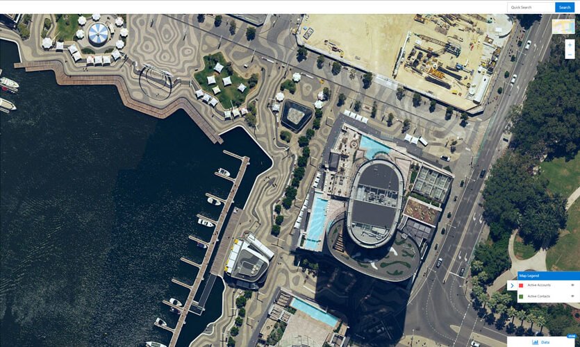
Bring in aerial imagery direct to Dynamics 365 for accurate ground intelligence. Make informed planning and maintenance decisions before you visit the site. Support services like MetroMap and Nearmap. Own drone/photo data and weather service.

Drone images of sites/assets
Visualise Dynamics 365 and existing infrastructure data using Maptaskr. Easily share your infrastructure data with Dynamics users. Enable your field staff to take actions by providing them with relevant business-critical data, and put your Dynamics 365 data in context with ArcGIS data.
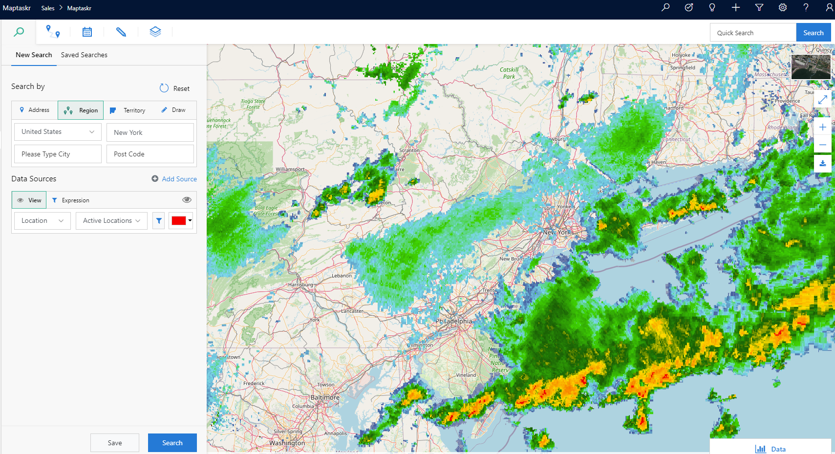
Layers
Does Weather have a big impact on your field workers’ tasks? What about fires? Show third-party layers together with your data for forecasted weather, drought prediction, railroads, radar, and many more services.