
Government
Data-driven decision making
Forward-thinking governments prioritise strategies, policies, and workflows, enabling them to make data-driven decisions, maintain awareness of community activities, and stay better connected. Maptaskr provides the ability to provide government staff and the community with reliable and trustworthy coverage over any area of interest on Earth, helping governments ensure safer communities, economic efficiency, a cleaner environment, and detect changing conditions rapidly.
Visualising accurate geospatial data is indispensable for urban planning, emergency response, community engagement, and capital projects assessments.
Effective oversight
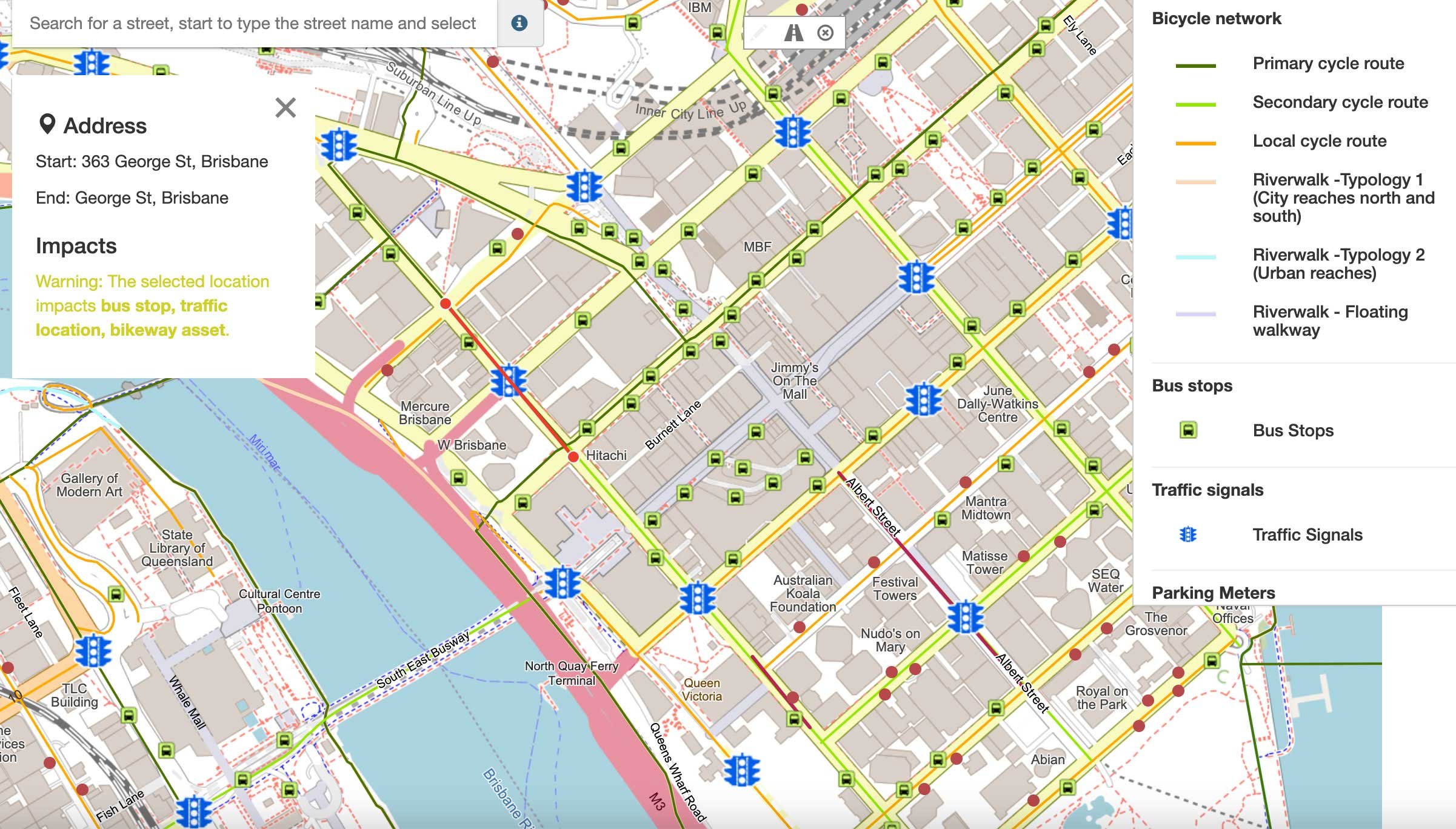
Easily review proposed activity in the context of current surrounds, augmented with addition information to show context for amendment requests. Identify hidden relationships within data that will help with decision making, risk mitigation & environmental regulation.
Accelerated Decision Making
Enable immediate access to accurate data in order to expedite decision making. Supporting authorities to fast-track assessment processes unblocks key economic decision making whilst ensuring environmental sustainability.
Rapid resPONSE
Effectively support office or in-field emergency response activity by enabling access to key data. Empowers authorities to assess situations more accurately, plan effective action and coordinate activities.

Emergency response management
Real-time information presented via Maptaskr assists with rapid and effective response to disasters, while frequent monitoring and a continuously refreshed image archive allows governing bodies to identify land changes and to prepare for emergencies as they arise. Plot emergency vehicle routes: view the best access points, coordinate response, identify the fastest routes to the rescue point, and assess potential obstructions.
Assessment, Compliance and permit management
By visualising detailed, current, and comprehensive data about land use, governments can protect their natural resources with ease. Maptaskr allows an extensive view of the natural world to protect forests, farmland, and bodies of water from illegal human activity, destructive pests, and natural disasters.
View any location on Earth with all the relevant overlays needed to assist with Assessments. Simplify Land Management by being able to monitor adherence to permits remotely and ensure Compliance by identifying breaches of code and illegal activities.

Public Planning
Gain a high-level view of the ever-evolving urban landscape, monitor the progress of large construction projects for more accurate reporting, and improve the systems that matter most to communities. Augment visualisations with customer and business data, allowing a true 360° view of population areas.
Allow strategic planning, support up-zoning decisions, monitor evolving regulations, update CBD mapping, and document property changes over time.